


Municipality of Cimișlia is one of the approximately 150 beneficiaries of the technical assistance project provided by the Government of the Kingdom of Norway via Norwegian Cartography Authority Statens Kartverk. The project is implemented through the Agency for Land Relations and Cadastre, in partnership with the Congress of Local Authorities of Moldova (CALM). All these localities will come into possession of high-performance computers that will allow them to use, through network services, the spatial data sets available within the central public entities, also to create thematic digital maps, complex spatial analysis for a better and accurate decision-making process with higher quality services provided to citizens. Municipalities will be equipped with multifunctional color printers, which will allow them to scan and digitize schemes, plans, projects, etc., but also print the necessary cartographic material in the administrative and decision-making process of local public authorities. All specialists in land administration within these municipalities are trained how to use during their work process an open source software – Quantum Geographical Information System (QGIS) – one of the most powerful tools for manipulating spatial data available for free.
Cimișlia municipality came into possession of such a set of ultramodern technology for the activity of specialists in land administration, databases and maps. The mayor of the town, Sergiu Andronachi, states that thanks to the Norwegian people, his town will have not only high-performance technology, but also a consistent database. “Having experience as a director of the municipal enterprise on water and sanitation and as a mayor, I can confirm that we do not have technical documentation, maps and positioning data for water and sanitation infrastructure objects. With no specific data, efficient administration and delivery of a quality service to citizens becomes an extremely difficult task, sometimes even impossible. With the support of Norwegian partners we will have the opportunity to make an inventory of the entire water and sanitation systems, with the geographical positioning of these infrastructural objects. This is a first step towards the development of urban databases, with the possibility on a regular basis to inventory and to update data on physical infrastructure objects, spatial planning and digital evidence of all objects and processes in the administered territory – a mechanism used as part of a modern town administration process.”
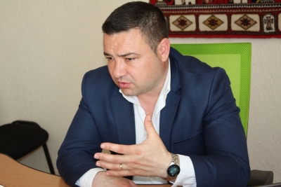
The local elected official underlined that for the specialists within the LPA this working method is an innovative one, and the trainings organized by the Norwegian partners are very useful. „We will be able to solve people’s problems faster and municipal specialists’ day by day work will become easier.”
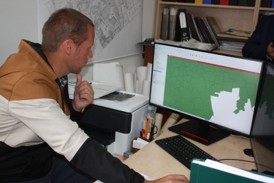
Ion Cazac, specialist in land administration within the municipality of Cimișlia, is confident that new programs and technologies will help him a lot in examining and preparing materials so that the decision makers can make correct decisions. “Every real estate has technical, volumetric and spatial positioning characteristics and the QGIS program gives us the opportunity to accumulate and store accurate and necessary information about all assets in the town.”
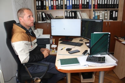
The specialist claims that before implementing this program, the maps were made with a pencil, and the measurements with the step in the field. “Now we have access through network services to digital databases in the cadastral area and to the national cartographic fund. Up until now, we kept all the information on paper, which deteriorates over time, becomes difficult to find or even it’s lost. Here we have online access to all available spatial information, we do not waste time and nerves. Moreover, a job well done, saves us time and increases the accuracy of the work done.”
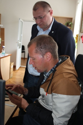
Galina Dulgher, a specialist in land administration at municipality of Cimișlia, says that until the reception of this set of modern technology, an outdated technique was used that did not allow the installation of specialized programs for cartographic work. She recommended all colleagues from LPA to improve their knowledge in this area.
It is to mention that the land fund of the administrative territorial unit of Cimișlia is approximately 12000 ha. Three villages are component part of administrative organisation: Bogdanovca Veche, Bogdanovca Nouă and Dimitrovca. The application of new technologies and knowledge in the field of land administration will allow more efficient management of this domain.
CALM Communication Service

 Felicitări cu ocazia Zilei Internaționale a Femeii!")

