


Donduseni municipality is one of the beneficiaries of the project “Maps for sustainable development of the Republic of Moldova”. The project was developed in partnership by the Congress of Local Authorities of Moldova, the Norwegian Mapping Agency and the Land Relations and Cadastre Agency.
Dondușeni Mayor Ivan Belciug considers this a success for the team he leads, achieved with the support of CALM: “For our land regulation specialist, learning new technologies is exciting. The technique we received as a gift gives us a number of benefits, as we can work simultaneously in several programs, access and process several spatial datasets, and provide a much better result in much narrower terms.”
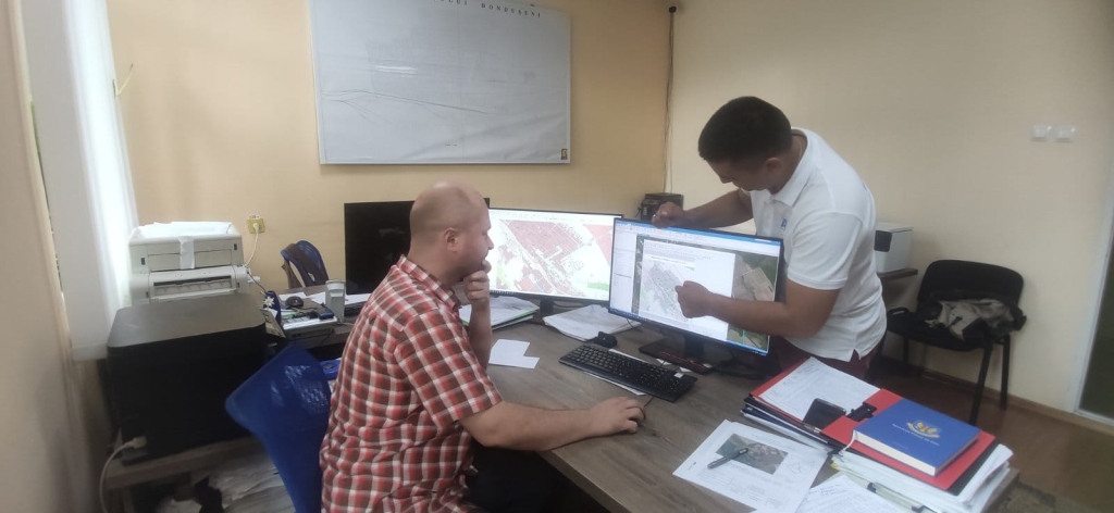
Ivan Belciug also spoke about the importance of the training courses organised in the framework of the project for specialists from municipalities on the use of QGIS. ” I have personally seen changes for the better in the work in this field. The combination of different datasets allowed us to more easily identify errors in the cadastral system, available land, illegally used land, as well as a better planning of the use of available land in our city.”
The local elected official said there are many complaints from citizens asking for exposure of the authority regarding the correct positioning of physical boundaries between them. “In the absence of topographical data that would reflect the history of the assignment and transmission in the field of the boundaries of the properties, the municipality is unable to expose an equidistant and correct position. Possessing such a technique, knowledge and access to multiple databases allows us to do a more complex analysis and establish exactly where the truth is. It also gives us the opportunity to provide an out-of-court way of settling land disputes between neighborhoods amicably.”

 Felicitări cu ocazia Zilei Internaționale a Femeii!")

